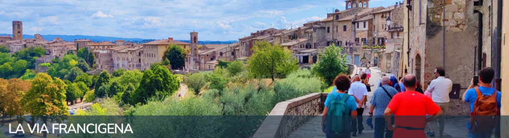
The History
Early Middle Ages
In the early Middle Ages, around the 7th century, the Lombards contested Italian territory with the Byzantines. The strategic need to connect the Kingdom of Pavia and the southern duchies by a sufficiently safe route led to the choice of an itinerary until then considered minor, which crossed the Apennines at what is now the Cisa Pass, and after the Magra Valley moved away from the coast in the direction of Lucca. From here, in order not to get too close to the areas in Byzantine hands, the route continued through the Elsa Valley to Siena, and then through the valleys of ‘Arbia and Orcia, to reach the Val di Paglia and the Latium territory, where the route joined the ancient Via Cassia leading to Rome. The route, which took the name “Via di Monte Bardone,” from the ancient name of the Cisa Pass, Mons Langobardorum, was not a real road in the Roman sense, nor even in the modern sense of the term. In fact, after the fall of the empire, the ancient consular routes fell into disuse, and except for a few fortunate cases ended up in ruins, “rupte,” so much so that the use of the word “route” to define the direction to be taken dates back to that era. .
The road
The Roman pavements gradually gave way to bundles of paths, tracks, tracks beaten by the passage of wayfarers, which generally spread across the territory to converge at tasks (towns or hospices where lodging was found for the night), or at certain obligatory passages such as passes or fords. Rather than roads, therefore, these were “road areas,” whose routes varied due to natural causes (overflows, landslides), changes in the boundaries of the territories crossed and the consequent demand for gabelle, and the presence of brigands. The bottom was paved only at the crossings of settlements, while in the connecting sections beaten earth prevailed. It seems, therefore, clear that the reconstruction of the “real” route of the Via Francigena would be an impossible undertaking today, since this never existed: instead, it makes sense to find the main tasks and places touched by the wayfarers along the Via
Via Francigena is born
When Longobard domination gave way to that of the Franks, the Via di Monte Bardone also changed its name to Via Francigena, or “road originating in France,” the latter name which in addition to present-day French territory included the Rhine Valley and the Netherlands. At that time traffic along the Via also grew, and it established itself as the main route between northern and southern Europe, along which merchants, armies, and pilgrims passed.
Pilgrimages over the course of history
Between the end of the first millennium and the beginning of the second, the practice of pilgrimage acquired a growing importance. The holy places of Christianity were Jerusalem, Santiago de Compostela and Rome, and the Via Francigena represented the central junction of the great faith roads. As a matter of fact, pilgrims coming from North travelled on the Via towards Rome and eventually along the Appian Way towards the bridges of Puglia, where they could embark for the Holy Land. Vice versa, Italian pilgrims that were headed towards Santiago, travelled on the Via towards North, to reach Luni, where they could embark for the bridges of France or they could continue towards Moncenisio and then to the Via Tolosana, that led to Spain. Pilgrimage soon became a mass phenomenon and this intensified the role of the Via Francigena, that became a determinant communication channel for the realisation of cultural unity, that characterised Europe during the Middle Ages.
Written sources
It is mainly thanks to the travel journals, and in particular the notes of the illustrious pilgrim Sigeric, that we can nowadays reconstruct the ancient path of the Francigena. In 990, after being ordained as Archbishop of Canterbury by Pope John XV, the abbot went back home noting on two manuscript pages the 80 mansions where he stopped for the night. Sigeric’s journal is still considered the most authoritative source, so much so that often we talk about “Via Francigena according to Sigeric’s itineraryâ€Â, in order to define a more “philological†version of the path.
The Itinerary
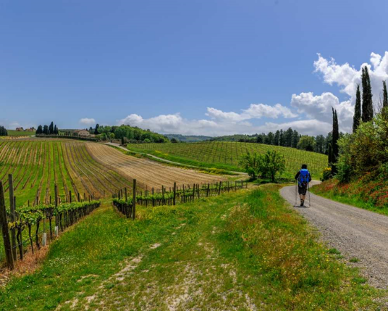
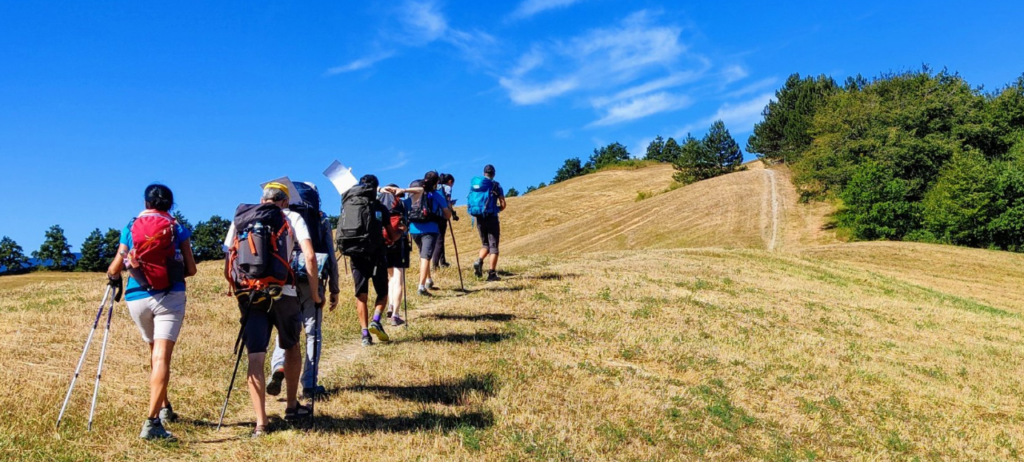
More than 3000 kilometers, from Canterbury to Rome and Santa Maria di Leuca, to walk step by step on mountain paths, mule tracks, rural and secondary roads, cypress-lined dirt roads or among majestic pines. Under your feet are the oldest streets of these beautiful countries. Streets paved with river stones worn by the passage of time, until you reach the “cobblestones†of Rome. The trail will take you through villages where all roads lead to Rome. The official route of the Via Francigena is the safest, and was carefully designed to be traveled by all ages.
Leg 30 – From San Miniato to Gambassi Terme
Departure: San Miniato, Convento S. Francesco
Arrival: Gambassi Terme, Chiesa Cristo Re
Total lenght: 23,9 km
Difficulty by foot: Hard
Description: A marvellous route, quite hard lacking road-houses. From San Miniato, after an hour walk along the asphalt road, enter an extraordinary track among hill crests in Val d’Elsa. During the Sigerico route you meet two submansiones: the Pieve of Coiano, in bad conditions, and the Pieve in Chianni, which parsonage is a hostel. Road-houses and water supply in Calenzano and an eating house 500 meters away from the Pieve of Coiano, towards Castelnuovo d’Elsa (off the itinerary). Water also in Piave di Coiano.
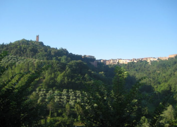
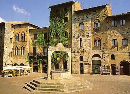
Leg 31 – From Gambassi Terme to San Gimignano
Departure: Gambassi Terme, Chiesa Cristo Re
Arrival: San Gimignano, Piazza della Cisterna
Total lenght: 13,4 km
Difficulty by foot: Medium
Description: A short moving route, rich in interesting views sorrounding Via Francigena. You can visit the Sanctuary in Pancole, before walking up the characteristic populated area in Collemucioli and the enchanting Pieve of Cellole. A visit is suggested to San Gimignano, one of the most visited destinations in Tuscany that, if reached on foot, can be enjoyed in a different way. Water supply in Pancole, there is no road-house along the walk.

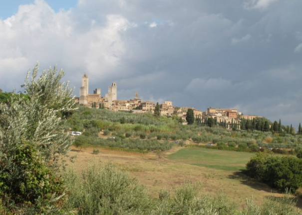
Leg 32 – From San Gimignano to Monteriggioni
Departure: San Gimignano, Piazza della Cisterna
Arrival: Monteriggioni, Piazza Roma
Total lenght: 30,5 km
Difficulty by foot: hard
Description: One of the most beautiful legs of the Via Francigena. Leaving S. Gimignano, after a hilly stretch, we arrive in the vicinity of one of Sigeric’s stops, which has not yet been precisely located: Molino d’Aiano.
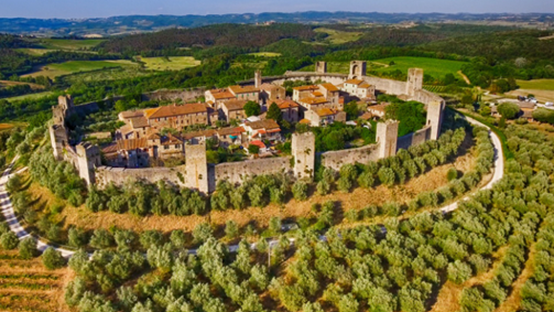
The route continues towards the village and castle of Colle di Val d’Elsa, whose cathedral preserves the relic of the Holy Nail, and then enters the “Sentierelsa†river park and continues to Gracciano, where the Pieve a Elsa, another of Sigeric’s stops, was located. After Le Caldane, ancient thermal baths from Etruscan-Roman times, we continue towards Strove, with its beautiful Romanesque parish church. We pass by the splendid complex of Abbadia a Isola before reaching Monteriggioni, with its unmistakable crown of towers.
Water and refreshment points are only available at the villages.
Leg 33 – From Monteriggioni to Siena
Departure: Monteriggioni, Piazza Roma
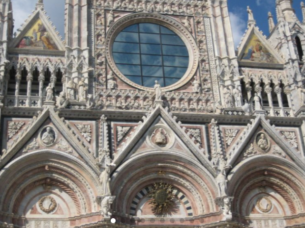
Arrival: Siena, Piazza del Campo
Total lenght: 20,6 km
Difficulty by foot: medium
Description: Description: Leaving the historic center of Monteriggioni behind, we travel along the white roads of the Sienese mountains towards Cerbaia, an ancient medieval village now in a state of abandonment. We travel through the bush to the castles of Chiocciola and Villa, before descending to the reclaimed riverbed of Pian del Lago. From here we travel a long stretch on asphalt before turning left onto Via dell’Osteriaccia. After about 600 m we suggest you leave the official route for a short but very interesting variant. Turn right onto the dirt road and walk up the hill until you reach the wonderful Hermitage of San Leonardo al Lago. You can visit it every day from 9:30 am to 3:30 pm. Ring the bell and Luca will open it for you, leading you to admire the church and frescoes. We then walk through the Renai woods before arriving at Porta Camollia, the traditional Frankish access to Siena.
The relatively short and easy stage is complicated by the almost total lack of water and refreshment points. At the “Punto Sosta La Villa” there is drinking water in the outdoor rest area, marked by a sign.